Last Updated on June 3, 2023 by Ellen
A fun, free, short hike into the clouds near Antigua, Guatemala is a great option for anyone who wants an easy hike outside the city. Bonus: there aren’t many tourists around.
Locals primarily use the trail in the hills between Antigua and Volcan de Agua. Tourists generally do not go there because it’s not as popular as the volcano tours sold in town. And we’ve done those volcano hikes – they’re great! But this is just an easy walk if you want to be in a peaceful forest for a few hours.
The place is called Parque Ecologico Corazon de Agua.
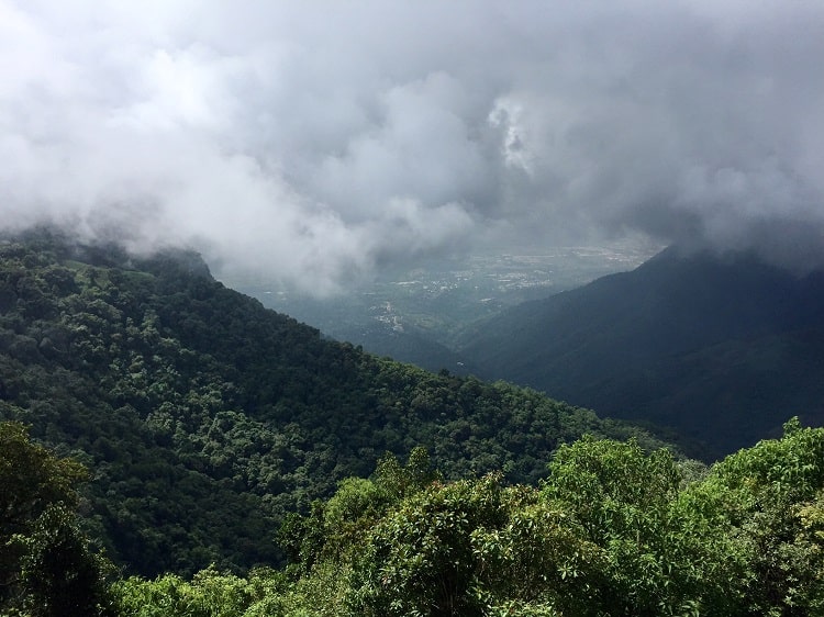
The hike was easy – despite a few slippery spots. This will be easier for people with longer legs. In three spots of steep inclines, it was a little tricky for me to step up high enough to find solid footing because of slippery mud. At one point, my husband pushed me up from behind because I started sliding backwards down an incline – my legs were too short to reach the next bit of hard earth. Luckily, I didn’t fall! It was muddy in a few spots because we went during rainy season. The time of year also made the vista in the park was obscured by clouds. But – having clouds roll by your face is pretty cool!
Hike into clouds in Antigua
Getting there
We went with our Airbnb rental host and new friend, and two of his great German shepherds. We never would have known to go there on our own.
He drove us out of Antigua on the main road towards Guatemala City, then turned off onto another road that took us through two villages on our ascent up into the hills. Once we passed the village of Magdalena Milpas, we parked his truck and got the dogs out of the back and started walking at the sign pictured below. It took us one hour to go from that sign to the summit in the park. We stopped once for a few minutes when we were nearly there to water the dogs and us humans.
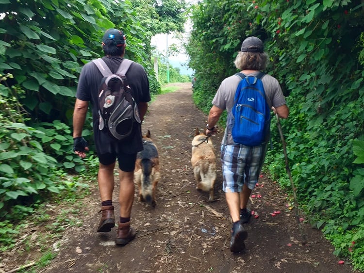
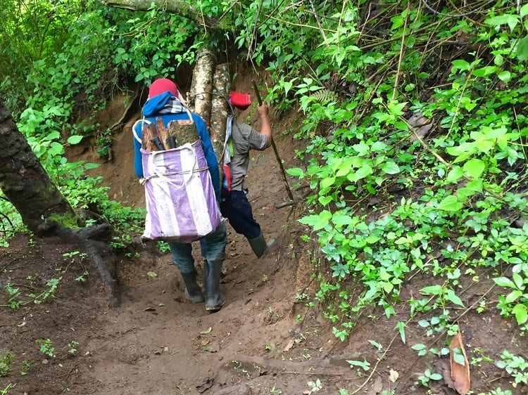
We walked by a few cultivated fields, including a coffee farm. The path was well-marked, and we didn’t see any other tourists at all. We went on a weekday morning. The only other people we passed on the trail were Maya people carrying firewood in sacks balanced on straps over their shoulders and foreheads.
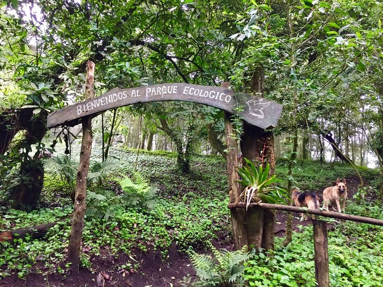
Once we got the actual park, a large sign welcomed us. When you see this – you are virtually there, just have to go up a little more.
More details about the park
On a clear day you can see a view of Lake Atitlan on the outskirts of Guatemala City, but we only saw a couple of villages below when the clouds cleared for a few minutes. Most of our time at the top was shrouded in clouds. I didn’t care.
There’s a sign at the top that claims the summit is 2,440 meters, or about 8,000 feet. Of course, we didn’t start at the bottom – we drove up passed the villages with the truck so I’m not sure how far we ascended on foot, but it wasn’t much.
A man came strolling along once we reached the top to collect an admission fee of about $1.30 each. People can camp at the park site for an additional small fee, but there aren’t any real facilities. Our friend told us there are several people on the trail and in the park on the weekends – that it’s much more crowded than on the Tuesday morning when we went.
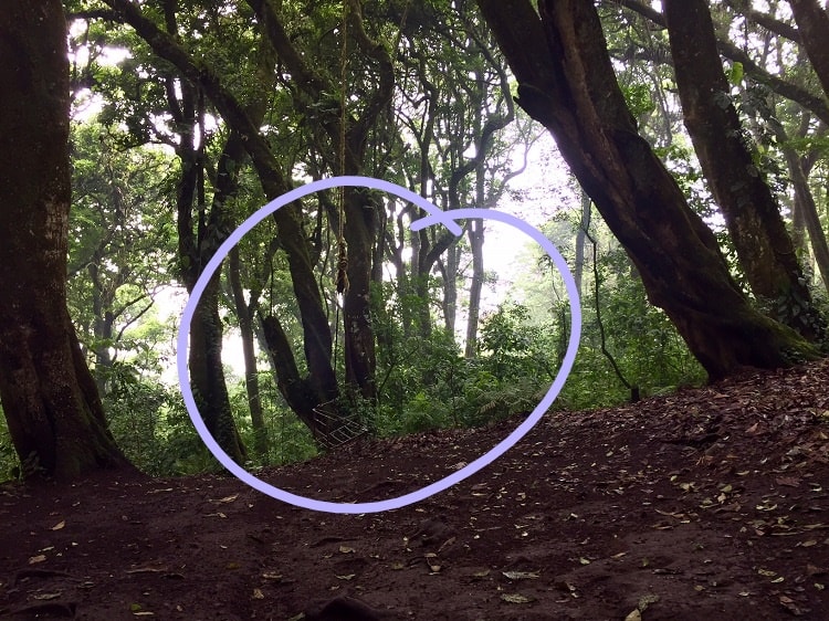
We stayed in the park for awhile. It was peaceful and pleasant, and we watched clouds blow by our faces. There are plenty of benches in the park, and a few lookout points to snap pictures. Even a few adult swings among the trees in the forest right around the park.
One is circled in the picture below, because it’s tough to make out.
It took about 40 minutes to get down because I went slow on the mud. The trail is a loop to the park, so you don’t pass some different sights on the way back.
If tourists were to go by chicken bus, you could get off in the village of Magdalena Milpas and ask directions for the road to the park. Add maybe another 30 minutes (or more) to your ascent, and some time for the way back down. The best way to go is by car, like we did, but it’s still possible to go without one.
Corazon de Agua has a Facebook page in Spanish. It’s here. I could not find a regular website, and the only other information in English I could find on the trail to the park were a few videos uploaded by mountain bikers, which won’t do much good for hikers.
One thing I miss in the kind of travel lifestyle we live is that we can’t have pets. I loved that we got to be outside with a couple of beautiful dogs. It made the trip even more special for me.
Related:
- Why tourists never heard of Tecpan, Guatemala, and why you should go
- Tzununa waterfall at Lake Atitlan revealed – plus a great Instagram spot!
- Bucket list on a budget: cheap swim with whale sharks in Mexico
